


Google Play
$4,907,176 MXN
For Sale
Industrial Lot in Apaseo el Alto Centro, Apaseo el Alto
LAND FOR SALETERRENO EN VENTA
Exclusive use photographs of
RE/MAX REAL ESTATE CONSULTING
Any use without authorization will be reported.
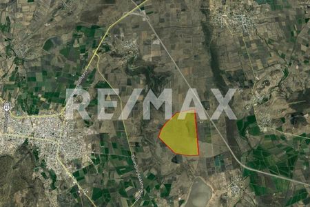
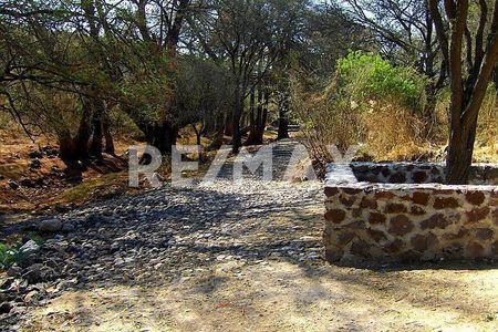
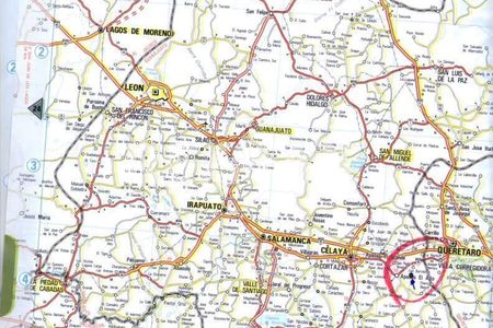
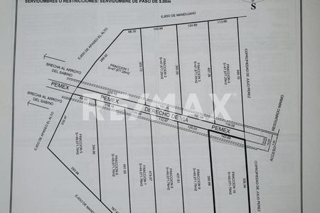
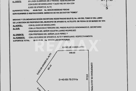
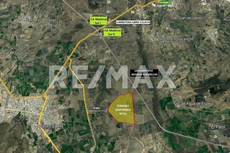
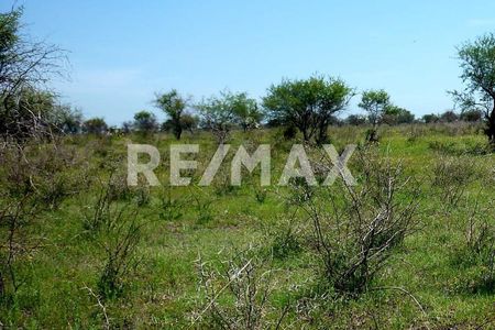
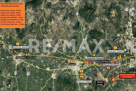
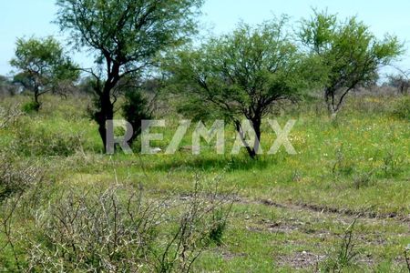
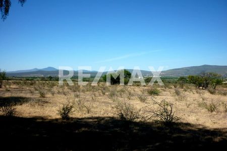
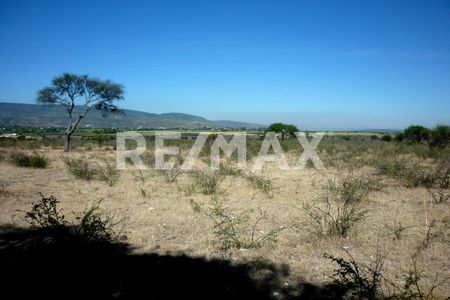
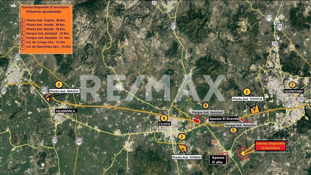
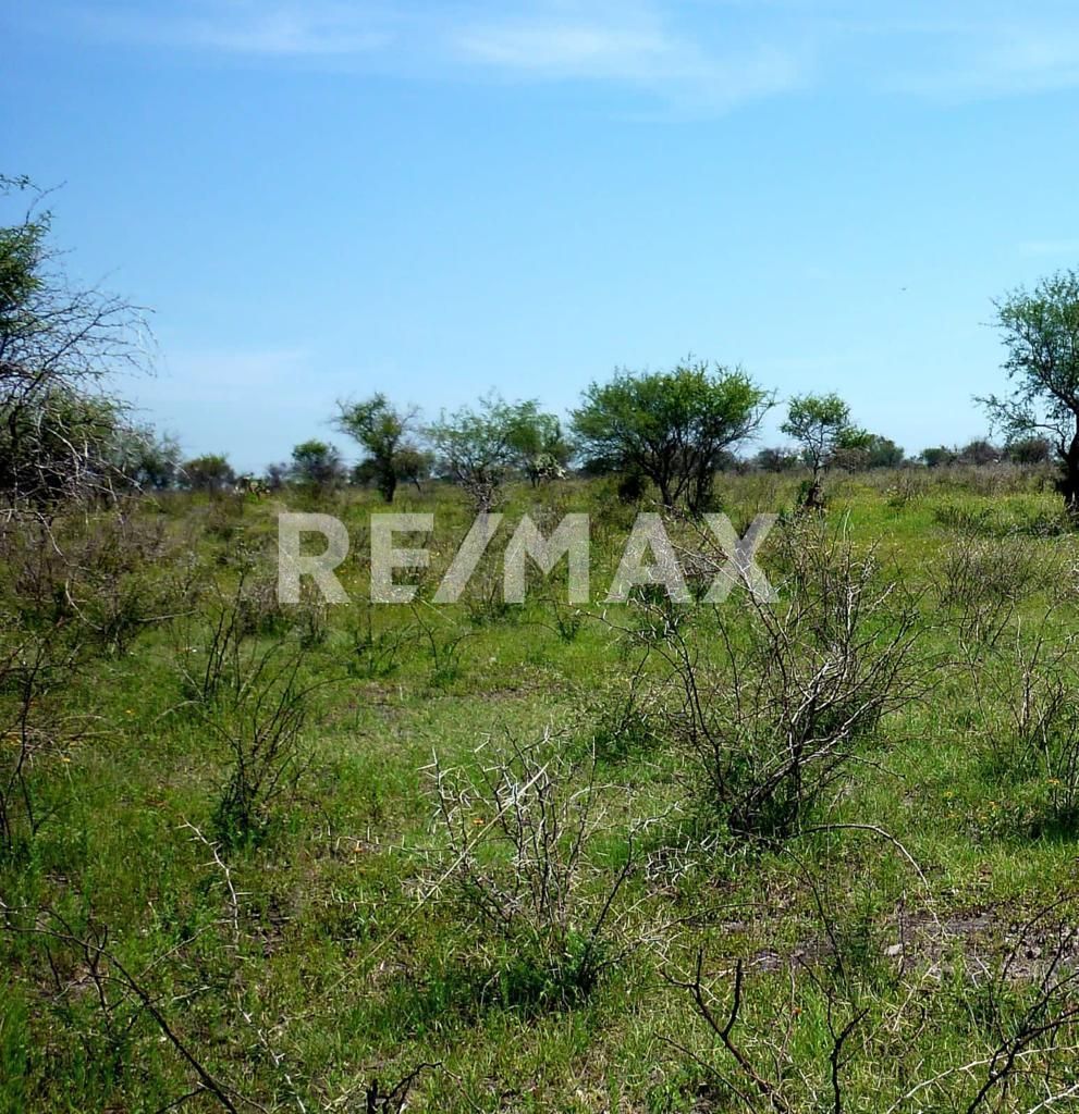
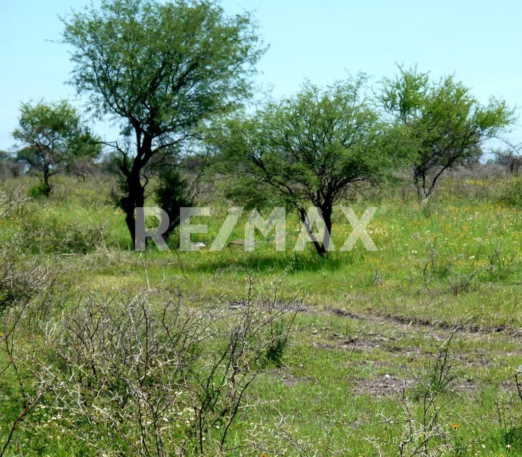
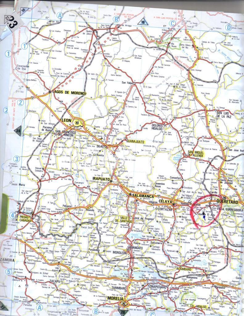
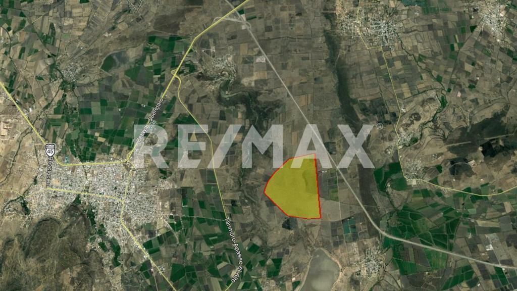
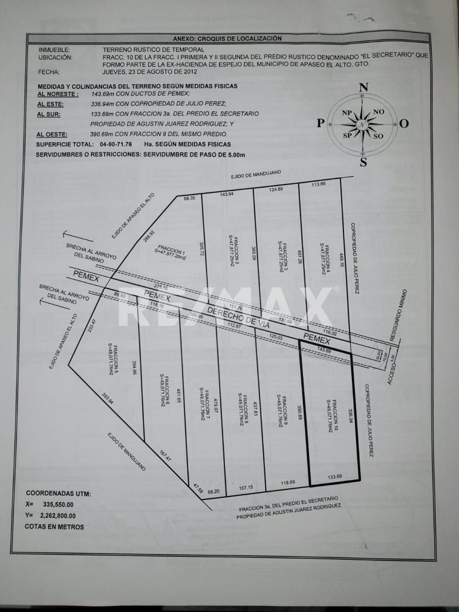
LAND KNOWN AS "EL SECRETARIO" Apaseo el Alto, Gto. AREA: 49071.76 Square Meters LAND USE: Agricultural and livestock with feasibility for residential and/or industrial use. LOCATION: In the center of the Municipality of Apaseo el Alto, Gto. On the free road Querétaro-Celaya. 1.5 km from the Jerécuaro bypass and 1.5 km from the Palmillas-Apaseo el Grande bypass. TOPOGRAPHY: Flat land with a slight slope, without significant topographical unevenness. PEMEX: The land is crossed by Pemex pipelines and has a satellite plan that provides for the right-of-way specifications according to the regulations of that company. STUDIES: Geophysical and Geohydrological. LIENS: Property free of all liens. CATASTRAL KEY: 04A000177002 TAXES: Up to date until 2023.Fotografías de uso exclusivo de
RE/MAX CONSULTORÍA INMOBILIARIA
Cualquier uso sin autorización será reportado.
TERRENO DENOMINADO “EL SECRETARIO” Apaseo el Alto, Gto. SUPERFICIE: 49071.76 Metros Cuadrados USO DE SUELO: Agrícola y ganadero con factibilidad para uso habitacional y/o Industrial. LOCALIZACIÓN: En el centro del Municipio de Apaseo el Alto, Gto. Sobre la carretera libre Querétaro- Celaya. A 1.5 kms. del Libramiento a Jerécuaro y a 1.5 kms. el Libramiento Palmillas-Apaseo el Grande. TOTPOGRAFÍA: Terreno plano con ligera pendiente, sin desniveles topográficos importantes. PEMEX: El terreno es cruzado por las tuberías de Pemex y cuenta con plano satelital que prevé las especificaciones de derecho de vía de acuerdo al reglamento de dicha empresa. ESTUDIOS: Geofísico y Geohidrológico GRAVÁMENES: Propiedad libre de todo gravamen. CLAVE CATASTRAL: 04A000177002 IMPUESTOS: Al corriente hasta 2023.
Publisher

REMAX ConsultorÍa Inmobiliaria
Listing Data
- Listing ID EB-SI1199
- Operation Type Sale
- Property Type Industrial Lot
- Neighborhood Apaseo el Alto Centro
- Postal Code 38500

