







Google Play
$20,140,000 USD
For Sale
Lot in El Carrizal, La Paz
MACRO TERRENO EN VENTA DE 1,060 HECTÁREAS, EL CONEJO, LA PAZ, B.C.S.
MACRO LAND FOR SALE OF 1,060 HECTARES, EL CONEJO, LA PAZ, B.C.S.
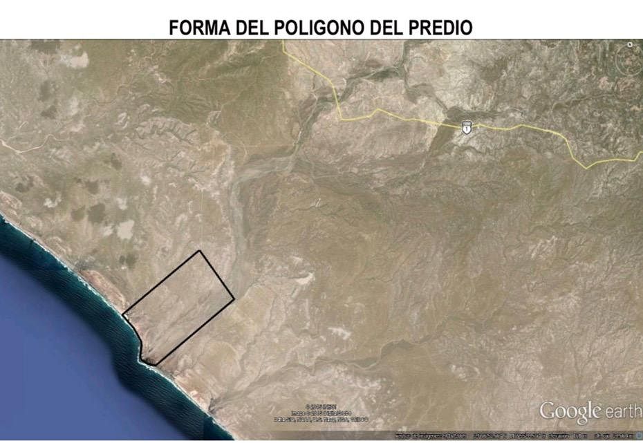
The property is known as RANCHO EL CONEJO, and as a reference point for fishermen, it is known as PUNTA CONEJO on Google Maps located as: "El Conejo, Baja California Sur".
It is a private property and has duly registered private property deeds in the Public Registry of Property and Commerce.
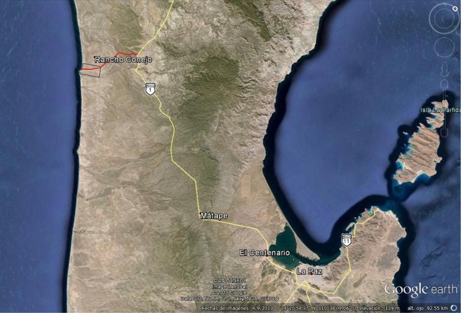
It is located between the towns of Ciudad Constitución and La Paz, is part of the municipality of La Paz Baja California Sur, and is located approximately 80 kilometers north of this Capital City. The nearest town to the site is the Ejido Conquista Agraria, which is located approximately 20 kilometers south of the property.
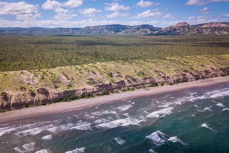
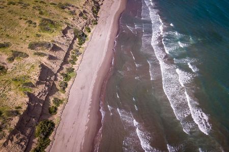
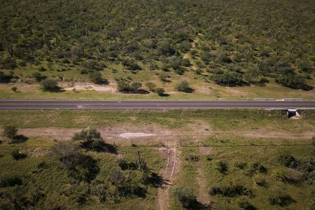
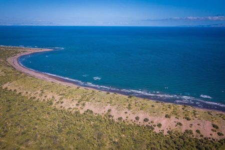
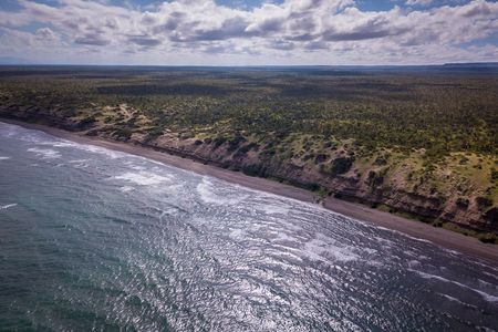
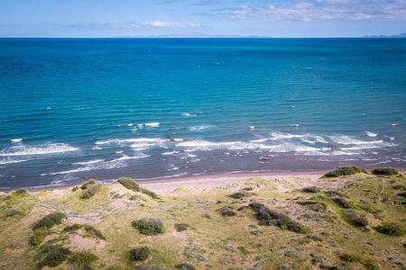
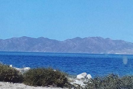
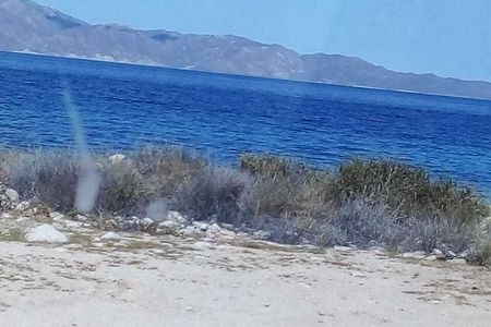
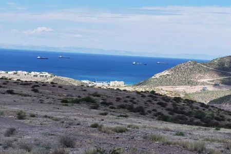
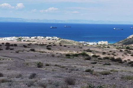
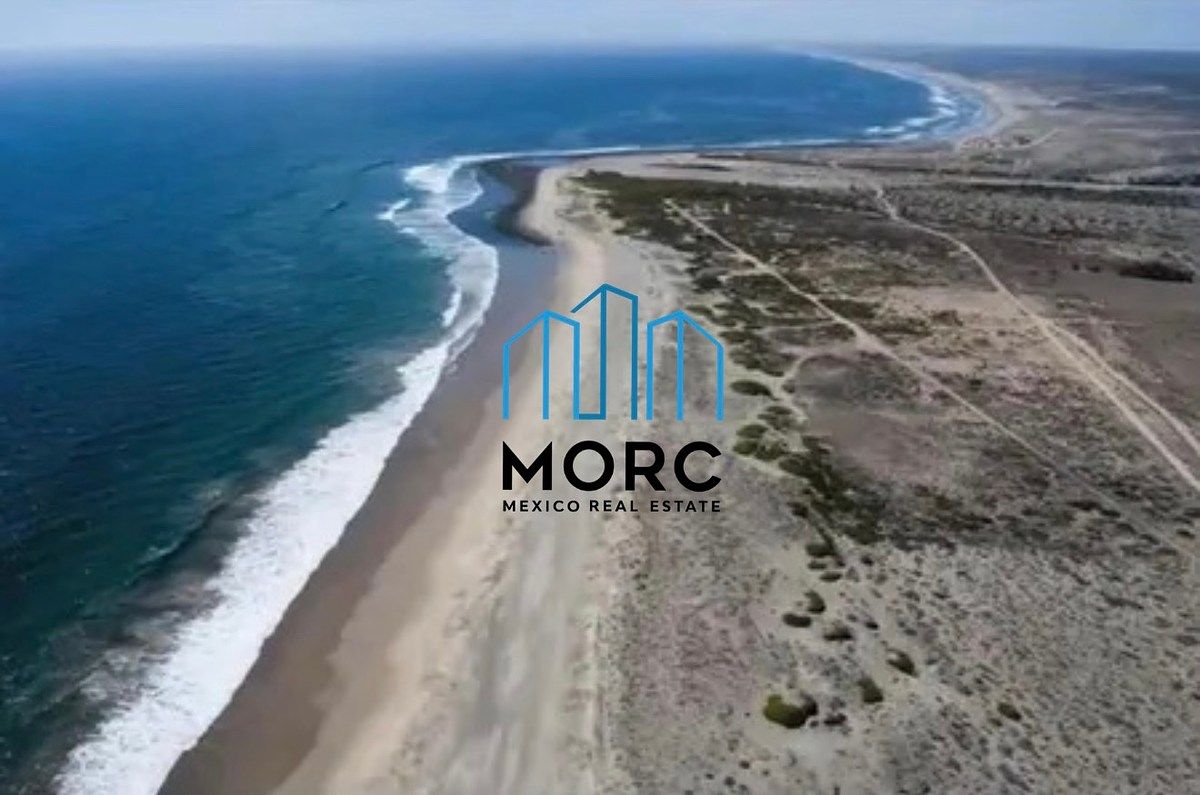
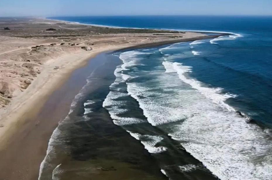
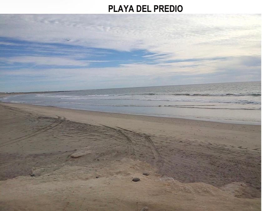
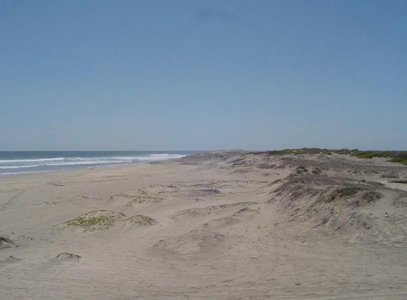
Rancho El Conejo borders the Pacific Ocean for 2.7 kilometers. The property borders the Pacific Ocean, crossed by the old rural road from the 60s that connected La Paz with Ciudad Constitución, Baja California Sur, and is currently used as part of the route of the international race "Baja 1000" organized by the promoter Score International. The site is visited for shore sport fishing and also for surfing by local and foreign tourists.
A C C E S S
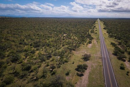
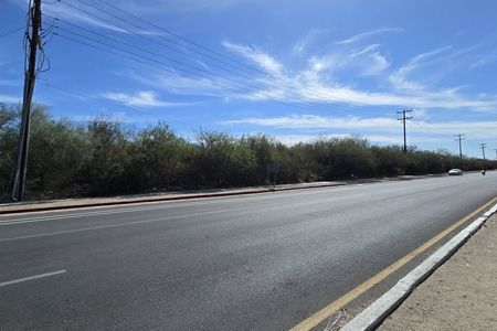
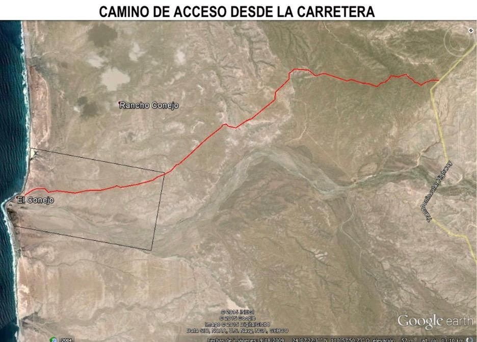
To access the property, it is necessary to travel along the Transpeninsular highway La Paz – Ciudad Constitución, and approximately at kilometer 80, you enter by a dirt road of approximately 12 kilometers heading west until you reach the Pacific Ocean. At this same distance of 12 kilometers, there is a high-tension line of towers from the Federal Electricity Commission.
LAND TREND
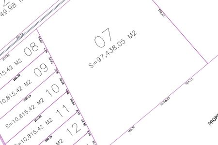
The property is a private property with a surface area of 1,060 hectares, has its private property deeds duly registered in the Public Registry of Property with Registration 576, volume 52 of the first section, free of encumbrance and up to date with its property tax payments.
SERVICES
The property lacks basic services as it is rustic; however, the nearest point for connection to the electricity supply network (CFE towers) is located on the La Paz-Ciudad Constitución highway at a distance of approximately 12 kilometers via dirt road or rural road. The Ejido Conquista Agraria also has a high-tension line via poles, which is located approximately 21 kilometers in a straight line to the El Conejo property. Although it does not have potable water service, the site has a concession for the exploitation of underground water valid until June 2025, for which an extension was timely requested. The authorized water volume is 160,000 m3 annually for agricultural use and 400 m3 annually for domestic use; this title is duly registered in the Public Registry of Water Rights of the National Water Commission.
C H A R A C T E R I S T I C S
• Total area of 10,600,000 m².
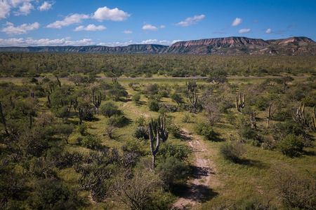
• Semi-flat land.
• Land ready to be deeded.
• Land with high traffic.
• High demand area.
PRICE
$1.90 m²
$20,140,000 USD.
LOCATION
El Conejo, La Paz, B.C.S.
https://maps.app.goo.gl/Tddyn2gHeR6tENFo9?g_st=ic
www.morc.mx
ventas@morc.mx
Advisor: Karla Ochoa.
Tel: 612 234 03 96 | 664 328 73 23 | +1 840 247 99 26 |MACRO TERRENO EN VENTA DE 1,060 HECTÁREAS, EL CONEJO, LA PAZ, B.C.S.
El predio es conocido como RANCHO EL CONEJO, y como punto de referencia para pescadores se conocen como PUNTA CONEJO en Google Maps de localiza como: “El Conejo, Baja California Sur”.
Es una propiedad privada y cuenta con escrituras de
propiedad privada debidamente inscritas en el Registro Público de la Propiedad y de Comercio.
Se localiza entre las poblaciones de Ciudad
Constitución y La Paz, forma parte del municipio de La Paz Baja California Sur y se ubica aproximadamente a una distancia de 80 kilómetros al Norte de esta Ciudad Capital. El poblado más cercano al sitio es el Ejido Conquista Agraria que se ubica aproximadamente a 20 kilómetros al sur del predio.
Rancho El Conejo colinda en 2.7 kilómetros con el Océano Pacífico. El predio colinda con el océano Pacifico, es cruzado por el antiguo camino vecinal de
los años 60´s que comunicaba a La Paz con Ciudad Constitución, Baja California Sur y que actualmente es utilizado como parte de la ruta de la internacional carrera “Baja 1000” que organiza la promotora Score International. El sitio es visitado para la pesca
deportiva de orilla e igualmente para la práctica del surf por turistas locales y extranjeros.
A C C E S O
Para acceder al predio es necesario circular por la carretera Transpeninsular La Paz – Ciudad Constitución, y aproximadamente a la altura del kilómetro 80 se ingresa por una brecha de terracería de aproximadamente 12 kilómetros en dirección al Oeste hasta llegar al Océano Pacífico. A esta misma distancia de 12 kilómetros se encuentra la línea
de alta tensión de torres de la Comisión Federal de Electricidad.
TENDENCIA DE LA TIERRA
El predio es una propiedad privada con extensión superficial de 1,060 hectáreas, cuenta
con sus escrituras de propiedad privada debidamente inscritas en el Registro Público
de la Propiedad con Registro 576, volumen 52 de la primera sección, libre de gravamen
y al corriente en sus pagos de impuesto predial.
SERVICIOS
El predio carece de servicios básicos por ser de tipo rústico sin embargo el punto más
cercano para conexión con red de conducción de electricidad (torres de CFE) se ubica
en la carretera La Paz-Ciudad Constitución a una distancia aproximada de 12 kilómetros
por brecha o camino vecinal. El ejido Conquista Agraria también cuenta con línea de
alta tensión mediante postes, la cual se localiza aproximadamente a 21 kilómetros en
línea recta al predio El Conejo.
Aunque no cuenta con servicio de agua potable, el sitio tiene una concesión para
explotación de aguas subterráneas vigente y con fecha de vencimiento en junio del año
2025, cuyo plazo fue solicitada su prorroga oportunamente. El volumen de agua
autorizado es de 160,000 m3 anual de uso agrícola y 400 m3 anual para uso doméstico,
este título se encuentra debidamente inscrito en el Registro Público de Derechos de
Agua de la Comisión Nacional del Agua.
C A R A C T E R Í S T I C A S
• Área total de 10,600,000 m².
• Terreno semiplano.
• Terreno listo para escriturar.
• Terreno con gran afluencia.
• Zona de alta demanda.
PRECIO
$1.90 m²
$20,140,000 USD.
UBICACIÓN
El Conejo, La Paz, B.C.S.
https://maps.app.goo.gl/Tddyn2gHeR6tENFo9?g_st=ic
www.morc.mx
ventas@morc.mx
Asesora: Karla Ochoa.
Tel: 612 234 03 96 | 664 328 73 23 | +1 840 247 99 26 |
Publisher


MORC MEXICO REAL ESTATE
Listing Data
- Listing ID EB-WF0898
- Operation Type Sale
- Property Type Lot
- Neighborhood El Carrizal
- Postal Code 23050


